
 This fresco was originally painted on the wall of the Marion Post Office in 1939 by Dan Rhodes. The work was commissioned as part of the Section of Fine Arts (commonly known as “the Section”) administered by the Procurement Division of the Treasury Department. Most post office works of art were funded by the Section, not through the Works Progress Administration (WPA), but they are often referred to as WPA works.
The mural remained an important part of the Marion’s Post Office until 1972 when the building was converted into the Marion City Hall. When the new City Hall was built in 2006, it prompted the Marion Historical Society to acquire and move the nearly 13-foot long historic fresco to the Marion Heritage Center.
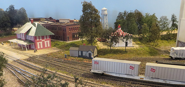
This model railroad exhibit in HO (1/87 scale) represents the Milwaukee Road rail line in Marion during the mid 1960s. The Milwaukee Road was the largest employer in Marion during that time. Darren Ferreter, a local professional model railroader, re-created a miniature Marion which includes the depot, downtown businesses, residential areas, bridge over Indian creek and three working trains.
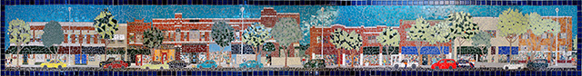 The concept for this mosaic was formed over the winter months of 2001 by area artists/educators Katie Virden and Karen Hoyt. They developed the idea into a viable project with the help of financial commitments from Farmers State Bank and the Marion Heritage Center. During the city’s annual Marion Arts Festival, hundreds of community members added tile pieces to the mosaic. The finished 12-foot long mosaic depicts the historic buildings along 7th Avenue in Marion’s uptown business district and hangs in the lower level lobby of the Heritage Center.
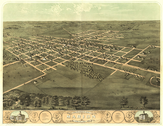 This 12-foot wide enlargement of the 1868 three-dimensional map drawn by Albert Ruger and printed by the Merchants Lithographing Co. of Chicago, gives the viewer a sense for the layout of early Marion.
Before photography, artists sketched communities from high vantage points or even hot air balloons. While the final illustrated panoramic maps were not to scale, they did give fairly accurate detail of the area. An archive featuring more than 1,500 illustrated panoramic maps is available online through the Library of Congress.